Chilly Start, Sun-Drenched Finish: San Antonio Emerges from the Deep Freeze
A Morning of Frost and Resilience
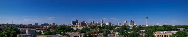
San Antonio residents are waking up to another biting cold morning this Wednesday, January 28, 2026. For many in the metro area, today marks the fifth consecutive day that temperatures have dipped below the freezing mark, solidifying this week as one of the most significant cold snaps in recent memory. Morning lows have settled between 27 and 31 degrees Fahrenheit, but the real story is the wind chill. With light northwest winds of roughly 5 to 10 mph, it will feel as though temperatures are in the teens or low 20s for early commuters.
Despite the frigid start, there is a silver lining in today’s outlook. The clear, mostly sunny skies that dominated the early hours will act as a natural heater for the city. Forecasters expect the mercury to climb relatively quickly compared to previous days, reaching 40 degrees shortly after 9:00 a.m. and hitting the 50-degree milestone by the lunch hour.
The Afternoon Thaw
The afternoon promises a much-needed reprieve for South Texas. High temperatures are projected to reach the upper 50s, with some areas just south of the city potentially touching the 60-degree mark. This warming trend is a welcome shift from the "mini ice age" conditions experienced over the weekend. Winds will remain light throughout the day, generally staying below 10 mph, which will make the afternoon sunshine feel quite comfortable for those running errands or working outdoors.
- Morning Low: 27°F to 31°F
- Afternoon High: 57°F to 60°F
- Conditions: Mostly sunny with light northwest winds
- Rain Probability: Less than 5% during daylight hours
Evening Transition and Safety Reminders
As the sun sets, San Antonians should expect a shift in the atmosphere. Cloud cover is forecast to increase significantly during the evening hours, leading to a mostly cloudy night. While no major precipitation is anticipated today, a stray shower cannot be entirely ruled out late tonight as a surge of moisture returns ahead of the next weather system. Overnight temperatures will once again hover near the freezing point, meaning the threat to vulnerable systems remains.
City officials and weather experts continue to emphasize the protection of the "Four Ps":
- People: Check on elderly neighbors and ensure those without adequate heating have access to warming centers.
- Pets: Bring all outdoor animals inside; if they must stay out, provide insulated shelter and non-frozen water.
- Plants: Cover sensitive vegetation or move potted plants indoors to prevent frost damage.
- Pipes: Insulate exposed outdoor faucets and allow indoor sinks to drip slightly to prevent freezing and bursting.
While Thursday is expected to be even warmer, another reinforcing cold front is already on the horizon for the end of the week. Enjoy today’s afternoon sunshine while it lasts, but keep the winter coats and frost blankets ready.